DJI RTK 3
Rent DJI RTK 3 Mobile Station in Sri Lanka for high-precision drone surveying, mapping, and construction projects with centimeter-level RTK accuracy.
- Description
- Additional information
Description
Premium DJI RTK 3 Mobile Station Rental in Sri Lanka
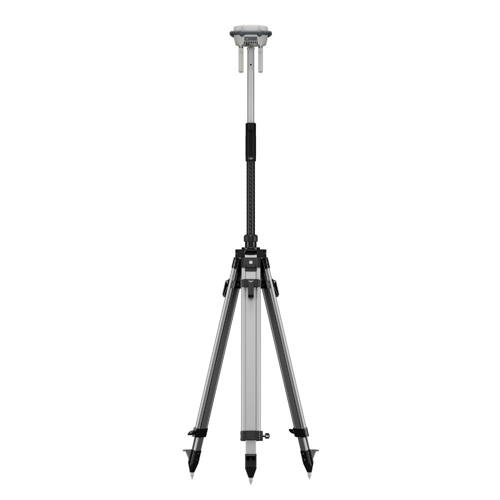
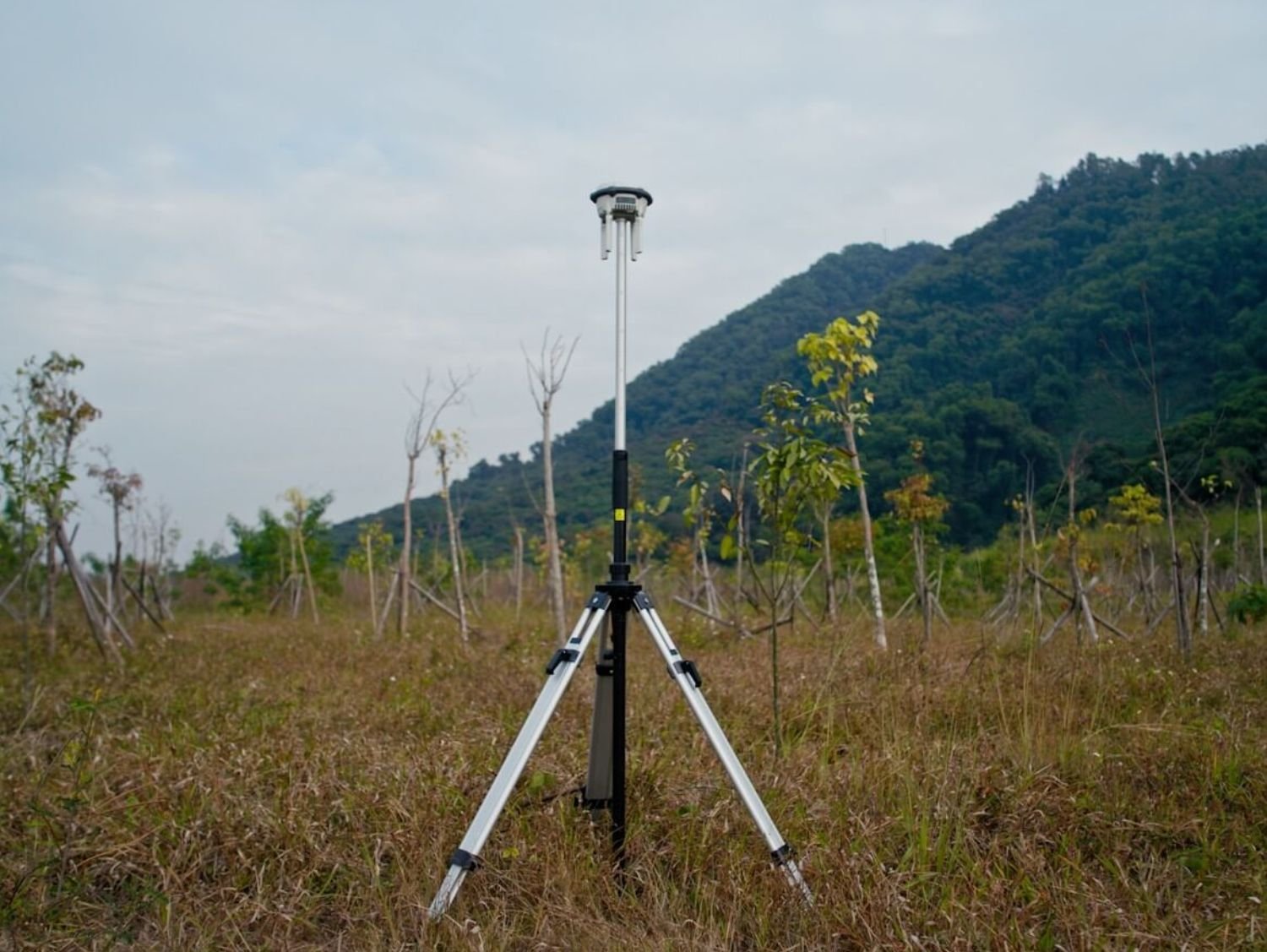
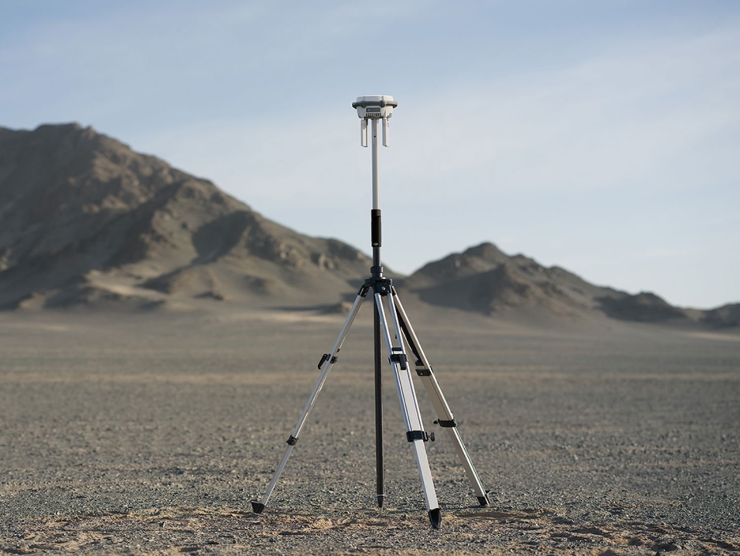
The DJI RTK 3 Mobile Station is a next-generation high-precision GNSS reference system designed for professional drone surveying, mapping, construction, and geospatial data collection. Renting the DJI RTK 3 Mobile Station in Sri Lanka allows surveyors, engineers, drone pilots, and infrastructure professionals to achieve centimeter-level positioning accuracy without investing in expensive permanent base stations. Built for reliability, portability, and fast deployment, The ideal solution for projects across Colombo, Kandy, Galle, Hambantota, Jaffna, and remote field locations.
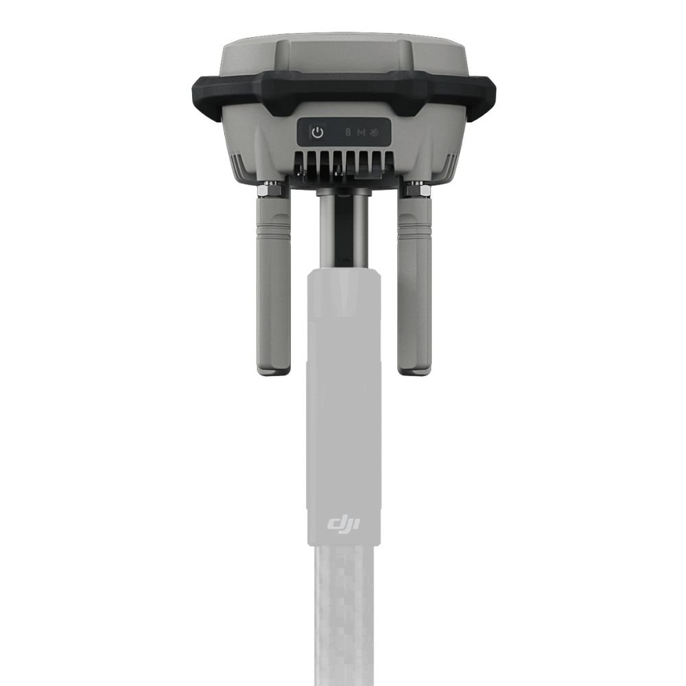
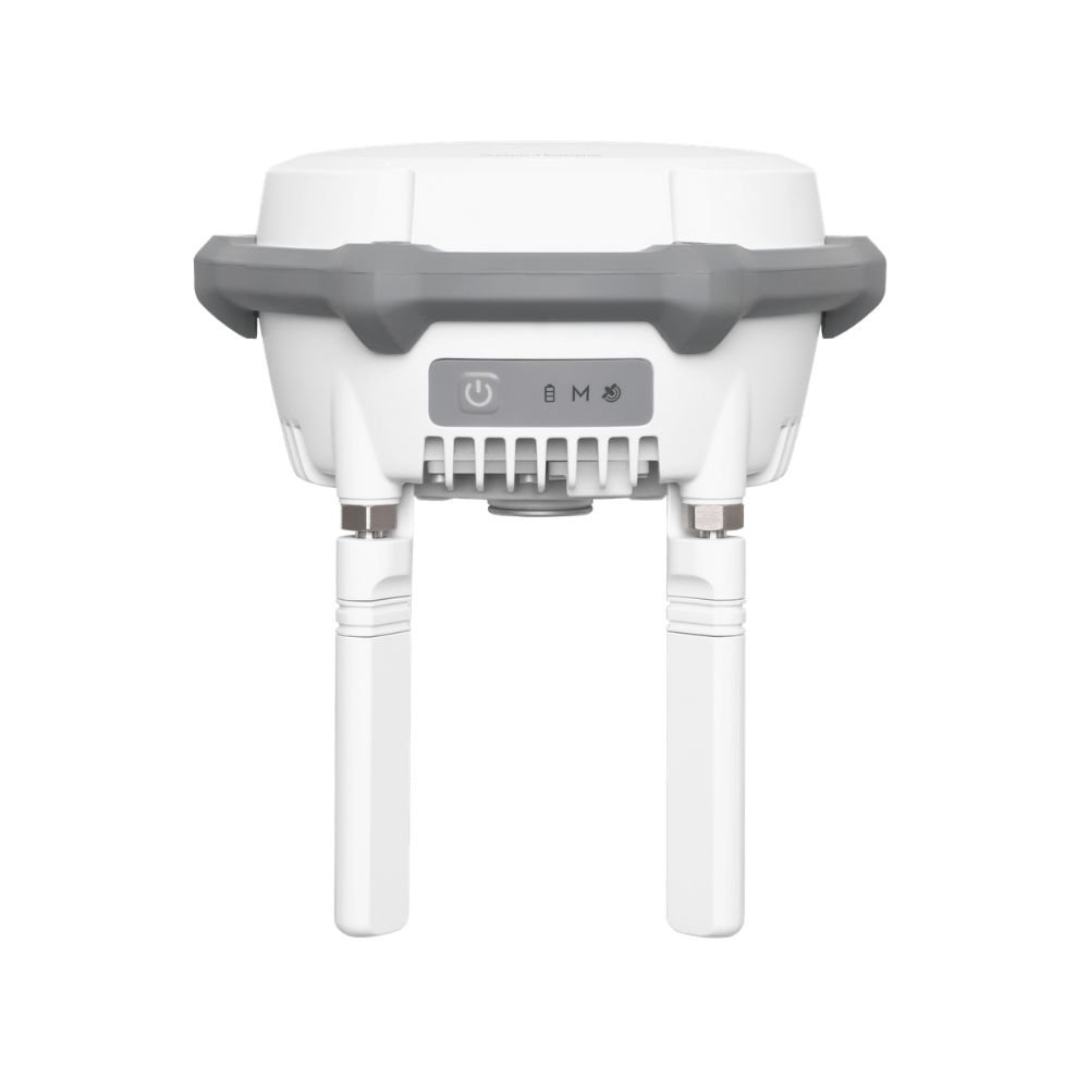
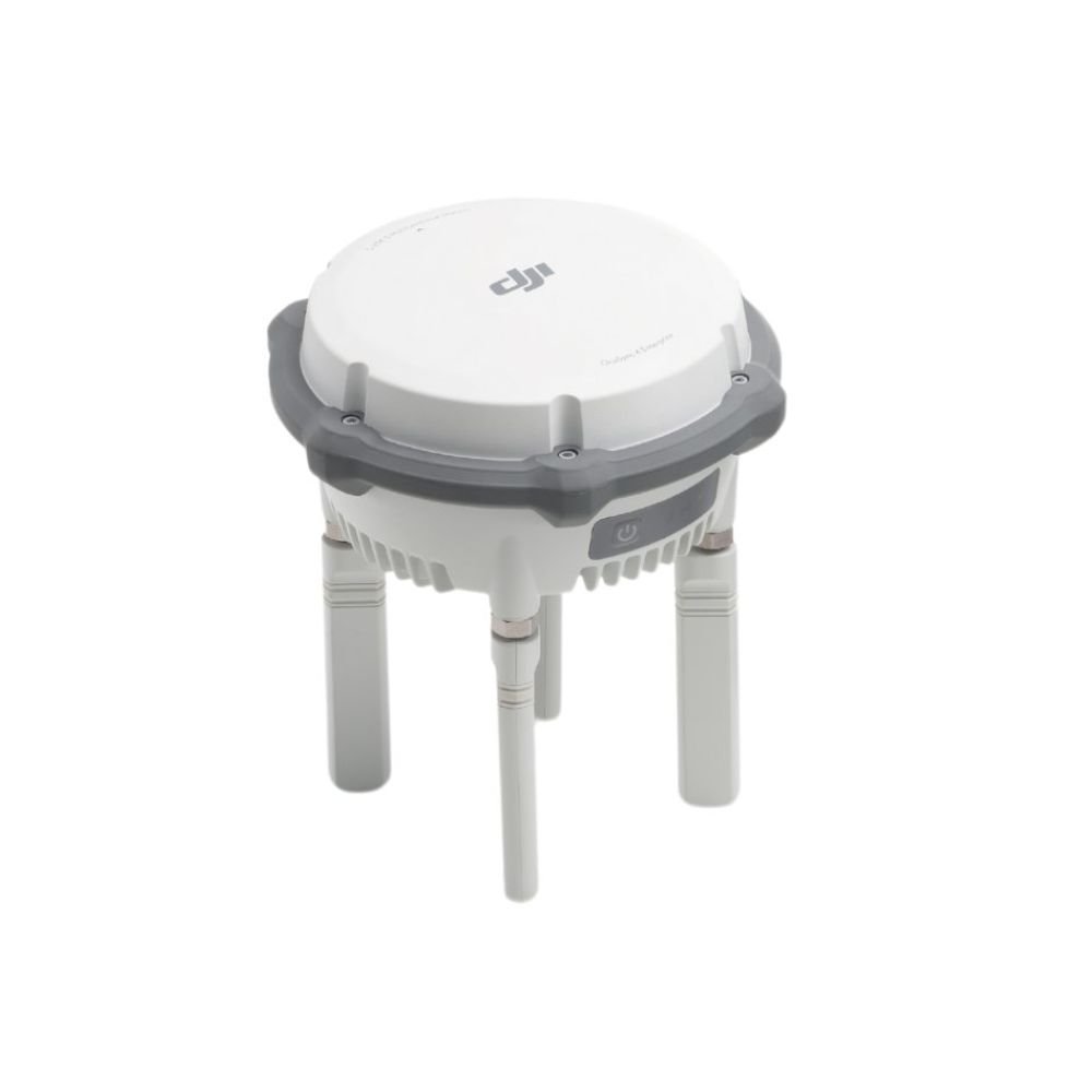
Equipped with advanced multi-frequency GNSS support, the DJI RTK 3 Mobile Station ensures stable and accurate correction data even in challenging environments such as urban areas, dense vegetation, coastal zones, and construction sites. The system is fully compatible with DJI enterprise drones including the Matrice and Mavic Enterprise series, enabling seamless RTK corrections for photogrammetry, land surveying, volumetric calculations, corridor mapping, and infrastructure inspections. Its rugged, weather-resistant design makes it suitable for Sri Lanka’s tropical climate, ensuring dependable operation during long outdoor survey sessions.
By choosing DJI RTK 3 rental in Sri Lanka, professionals gain access to enterprise-grade positioning technology without the burden of ownership, maintenance, or calibration costs. Whether you are conducting cadastral surveys, road development mapping, mining volume analysis, agricultural mapping, or government-authorized drone operations, the DJI RTK 3 delivers precise and repeatable results essential for professional-grade outputs.
Key Features & Main Specifications
The DJI RTK 3 Mobile Station features multi-band GNSS reception, supporting GPS, GLONASS, Galileo, BeiDou, and QZSS for enhanced satellite availability and signal stability. It supports RTK and PPK workflows, providing flexibility for real-time corrections or post-processed accuracy. With fast initialization times and strong anti-interference performance, survey operations remain efficient and reliable.
The unit includes a high-capacity internal battery, offering extended operating time for full-day fieldwork. Built-in wireless communication ensures seamless data transmission between the RTK station and compatible DJI drones or controllers. The compact and lightweight design allows easy transportation and rapid setup using a tripod or fixed mounting point.
DJI RTK 3 is engineered to meet professional surveying standards, making it suitable for engineering surveys, UAV mapping projects, environmental monitoring, construction planning, and infrastructure development across Sri Lanka.
Additional information
| Brand | DJI |
|---|---|
| Model | RTK 3 Mobile Station |
| Usage | Drone Surveying & Mapping |
| Accuracy Level | Centimeter-Level RTK |
| Rental Type | Daily / Weekly / Monthly |


